Hjem » The West Norwegian Fjords – a World Heritage site
The West Norwegian Fjords – a World Heritage site
The West Norwegian Fjords are among the most dramatic and spectacular landscapes in existence.
The World Heritage site incorporates two separate areas: Geirangerfjord and Nærøyfjord. Both offer a wide range of scenic experiences.

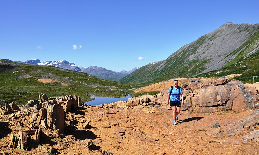
Photo Merete Løvoll Rønneberg
Outstanding qualities
The World Heritage site’s natural and cultural qualities have always mesmerised visitors. Many consider these fjords to be iconic of Norway, the Land of Fjords. The assimilation of the Norwegian word ‘fjord’ into international parlance is therefore hardly surprising.
The two fjord areas enjoy a vast range of habitats thanks to great differences in elevation and short distances between sea and mountain. They have largely escaped engineering intervention, so the geological processes that shaped them remain unaffected by man. Their combined cultural and natural qualities have earned them their inscription on Unesco’s World Heritage List.
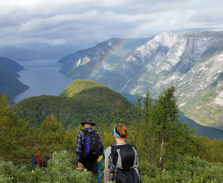
Photo Gry Mørk
Beautiful fjord landscapes
The Geirangerfjord and Nærøyfjord areas are reputed to be among the most beautiful fjord landscapes in the world. For over 150 years, they have been visited by researchers, artists and tourists seeking out dramatic scenery. The majestic fjord landscapes leave a deep impression on many and have provided inspiration for poets and artists. The natural and cultural qualities reinforce each other in a finely-tuned interplay. This is what we want all visitors to experience.
The West Norwegian Fjords were inscribed on the World Heritage List because the site was found to meet two of ten criteria, including no. 7 – ‘to contain superlative natural phenomena or areas of exceptional natural beauty and aesthetic importance’.
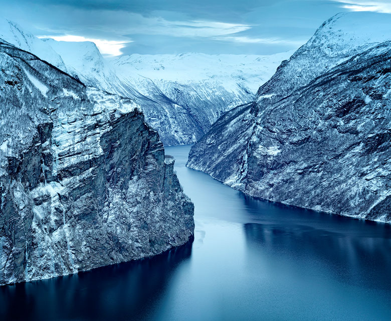
Photo Per Eide
A living geological landscape
The West Norwegian Fjords were deemed also to meet criterion no. 8 because the area features outstanding examples of major stages of Earth’s history as well as significant on-going geological processes. The area is an important ‘natural history laboratory’ that may increase our knowledge of how landscapes are formed, and about the consequences of climate change.
The many varied landscape formations show how rivers and glaciers shaped the fjord landscape. During the Tertiary Period 2.5–55 million years ago, the land was raised to form a high mountain massif. Rivers excavated deep V-shaped valleys before the many ice ages of the Quarternary Period rounded them into steep-sided U-shapes. But the fjord landscape has not yet fully evolved; this is a young, live and constantly changing landscape.
Every winter, local people prepare themselves for major avalanches. The rest of the year, rockfalls and landslides are part of everyday life.
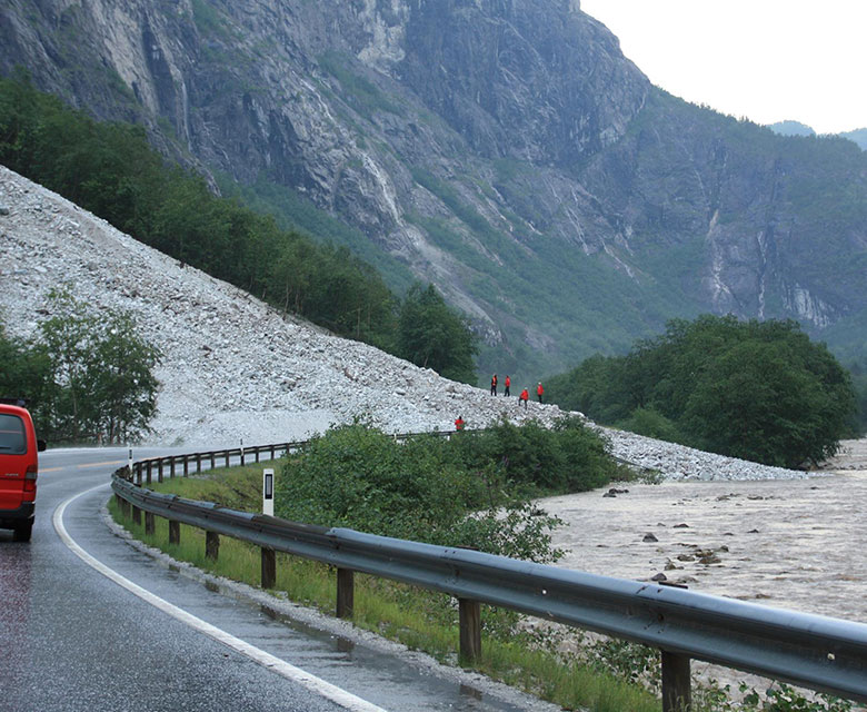
Photo Marunn Hylland
Man-made cultural landscapes and environments
People have made use of this landscape ever since the ice retreated around 10 000 years ago. Trapping pits and archery positions tell us that wild reindeer were important to the local population as far back as the Stone Age. There are shoreside farms as well as smallholdings perched on high crags above the fjord. People who settled here were subsistence farmers who adjusted to the natural hazards around them and harvested from nature by fishing, hunting and foraging.
Today, many smallholders have given up farming due to poor economic prospects. This means less grazing livestock. If this trend continues, the cultural landscape will become overgrown and some of our cultural history will be lost. Many local farmers receive support to continue farming and prevent fields from becoming overgrown. An active cultural landscape with grazing livestock helps us understand how everything connects. Preserving traditional dairy farming will enable later generations to experience the living cultural landscape.
Read more about action plans for the cultural landscapes:
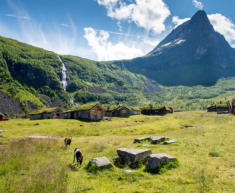
Photo Per Eide
Wildlife
Because the West Norwegian Fjords form a crossing point between climatic zones, the area is home to a rich variety of flora and fauna, with a multitude of wildflowers, fish, birds, insects and animals. The World Heritage site encompasses the deepest fjords as well as mountains over 1800 metres.
Alpine plants grow side-by-side with species that tend to thrive much further south. Rough pastures provide a habitat for rare plants that rely on grazing and hay-making to survive. Norway has a management responsibility for species such as wild reindeer, the Arctic fox, lynx, otter, lemming, the white-backed woodpecker and the harbour porpoise. There are seabirds and waders around the fjords, woodland birds in the valleys and alpine species in the mountains.
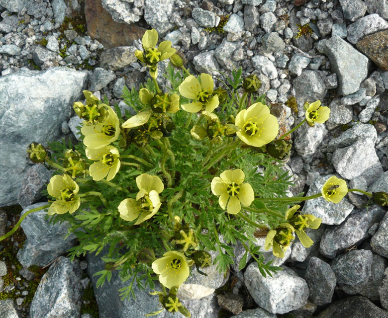
Photo Rein Arne Golf
Landscape protection areas and nature reserves
Most parts of the World Heritage site are landscape protection areas. This status directs attention to values we need to protect for the future. The flora and fauna of the mountain and fjord landscapes are particularly rich. Cultural landscapes and traces of past lives have added value to the natural landscape. Besides, Geirangerfjord and Nærøyfjord are among the few fjords that remain unaffected by major hydropower developments. All rivers run unimpeded down to the fjord. Landscape protection ensures that this will continue to be the case.
Protection restricts our freedom to impact on nature. The aim is not to make things difficult for people, but to prevent the loss of important natural values. Some areas are particularly valuable and have been designated as nature reserves. Here, strict rules apply for travel and intervention. We need unspoilt nature. Norway’s only natural heritage site on Unesco’s World Heritage List seems a good candidate for introducing the required safeguards.
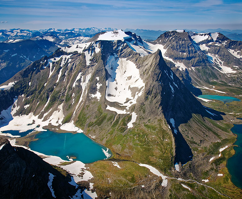
Foto Finn Loftesnes
Protected river systems
Rivers, streams and waterfalls played a key role in the formation of the fjord landscape, and they continue to erode the bedrock and moraines. Their impact shows us the enormity of nature’s forces. Man has put some of these forces to use, for instance through hydropower projects. Such schemes involve laying pipelines, flooding large areas and building enormous dams, all of which changes the geological landscape. Hydropower proposals within the World Heritage property are therefore highly contentious and could well threaten the status awarded by Unesco.
The West Norwegian Fjords and buffer zones include several river systems that are protected against development. This has sometimes been achieved through fierce campaigning, which has been taxing on small village communities. But the protection of river systems has been important for preserving unspoilt areas, and may well have been essential for the area’s World Heritage nomination.
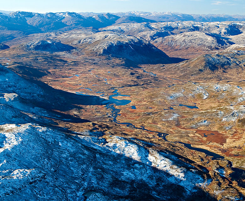
Photo Finn Loftesnes
Geirangerfjord
- Norddalsvassdraget river system
- Geirangerelva river
- Parts of Bygdeelva river downstream to Frøysa, Sunnylven
Nærøyfjord
- Vosso river system
- Flåmselvi river
- Undredalselvi river
- Dyrdalselvi river
- Nisedalselvi river
- Kolarelvi river
Aurlandsfjord and Nærøyfjord also enjoy special protection as national salmon fjords. National salmon rivers and salmon fjords (environment.no)
Facts and figures about the Geirangerfjord area
The municipalities of Fjord and Stranda in Møre and Romsdal County
Area: 518 km²
World Heritage fjords:
- Geirangerfjord (16 km)
- Sunnylvsfjord (22 km)
- Tafjord (8 km)
Populated areas: Geiranger village
Protected areas:
- Geiranger-Herdalen landscape protection area, 498 km². Protected since 2004.
- Kallskaret nature reserve, approx. 90 hectares. Protected since 1984.
- Hyskjet nature reserve, approx. 52.5 hectares. Protected since 2003.
Photo Merete Løvoll Rønneberg
Facts and figures about the Nærøyfjord area
The municipalities of Voss, Aurland, Vik and Lærdal in Vestland County
Area: 709 km²
World Heritage fjords:
- Nærøyfjord (17 km)
- Aurlandsfjord (29 km)
Populated areas: The villages of Undredal, Gudvangen, Nærøydalen, Bakka and Dyrdal
Protected areas:
- Nærøyfjorden landscape protection area, 564 km². Protected since 2002.
- Bleia-Storebotn landscape protection area, 66 km². Protected since 2004.
- Grånosmyrane nature reserve, 3.4 km². Protected since 1995.
- Nordheimsdalen nature reserve, 13 km². Protected since 1999.
- Bleia nature reserve, 22 km². Protected since 2004.
- Geitanosi nature reserve, 22 km². Protected since 2020.
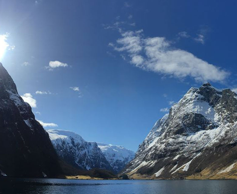
Photo Ane Oppheim